- London is on the River Thames, Westminster is right next to it to the West (north of the river; Southwark is south of the river), and Whitehall is the working court of the Tudors and Stuarts in Westminster. Greenwich, another royal palace at the time of Elizabeth, is farther down the River Thames to the East (on the South bank of the river). Tilbury is farther down the River Thames to the East, as it opens up to the North Sea (on the North bank of the river). This is where Elizabeth placed her troops in case the Spanish had landed in 1588.
- Canterbury is NOT on any map in the first edition of our textbook. But it is in Kent which is to the South and East of London. The archbishop of Canterbury controlled most of the dioceses South of York and the archbishop of York controlled York and those to the North. [See the following map of late Medieval dioceses (one or two were added later).]
- Norwich (on the diocese map above–all dioceses have a Cathedral in them as that is the head of that region, also known as a bishopric).
- Oxford, Cambridge, are the two English university towns in the 16th-17th century period and are, respectively Northwest and Northeast of London. Oxford is farther up the Thames although it is, of course, a much smaller river by then. Cambridge became more associated with Puritanism during Elizabeth’s reign. (Both are on this map of England.)
- Holyrood Palace was and is a royal palace in the midst of Edinburgh. Mary Queen of Scots used it in the 1560s.
- Borders: Welsh Marches is a nebulous area, basically the border of Wales [see this map of a Trail that goes along the Anglo-Saxon Offa’s Dyke; or see a map of the region]. The Welsh Marches were originally established by the Normans to give some barons extra powers to keep the Welsh in check. By Elizabethan times, the Council in the Marches in Ludlow, Shropshire provided a local law courts for the region, so people wouldn’t have to go to London.
- Berwick-on-Tweed was another nebulous area, though this time just a city. On the River Tweed dividing England and Scotland, Berwick still has some Elizabethan ramparts which protected it from Scotland. In 1603, James VI of Scotland passed this way on his way to becoming James I of England.
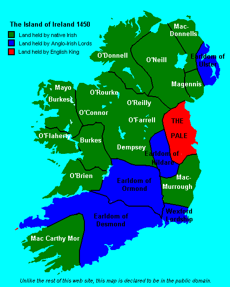
- Ireland: The Pale is nicely portrayed on this map circa 1450. Dublin would be in the nice rounded inlet on the south-central shore of the Pale. (The Pale is also in Leinster, but I won’t have that term on the exam.) Instead, I will choose from questions that ask you to locate Ulster in the North and East, Munster to the South and West, and Connaught in the central West (see this map of the four ancient provinces). Connaught is the most rugged and rocky. Ulster was the home of the leaders of the Clan O’Neil that the Tudors tried to pacify as the earls of Tyrone, but which broke out in war in the 1590s. Essex wandered around Munster (reinforcing its main port town of Cork) and Connaught to defeat O’Neil (which is strange, as the sentence above shows that O’Neil was mainly in Ulster).
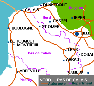
- Not English: Paris, Antwerp and Flushing (now Vlissingen) are ports in the lowlands: Belgium today; Antwerp is in Flushing is on an island next to the English Channel in the Netherlands today. Both are located north of Calais and Dunkirk on the following map.
- Both had some importance in the Armada saga. The Catholics established a school for English Catholics in Douai in 1568 (and, I think, another in Flushing; the Dutch were pretty tolerant). [Finally, Douai is farther from the coast than I thought.]
Tuesday, October 28, 2008
Mapping, chs. 4-5, 7, Early Modern England
Additional information for a map quiz, based largely on the Elizabethan and Early Stuart chapters of Early Modern England: London, Oxford, Cambridge, Canterbury, Norwich, Edinburgh (Holyrood Palace), Paris, Antwerp, Douai, Welsh Marches, Tilbury, Flushing (now Vlissingen), Ulster, Munster, The Pale, Connaught, Dublin, Westminster (Whitehall), Greenwich, Berwick.
Subscribe to:
Post Comments (Atom)


No comments:
Post a Comment